
Data integration and fusion
Combines BIM, GIS and IoT data and consolidates project data from planning through handover.
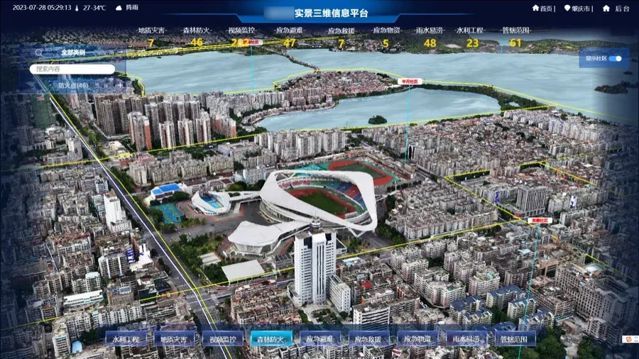
A digital twin city built on GIS, BIM and IoT, with urban data connected in one view.
OVERVIEW
The Smart City system builds a digital twin city based on GIS, BIM and IoT. It integrates various urban model entity data and connects urban statistical data, government big data and social big data.
It supports data collection, fusion and visualization, urban health monitoring and analysis, comprehensive security and emergency response, and urban development trend forecasting.
CAPABILITIES
Combines BIM, GIS and IoT data and consolidates project data from planning through handover.
Reproduces the urban physical space and its operational status.
Visualises the city’s operational status and development trends.
Uses data analysis and AI to support planning and decision-making.
Start your digital twin
We can arrange a targeted demo around your data, devices and workflow.